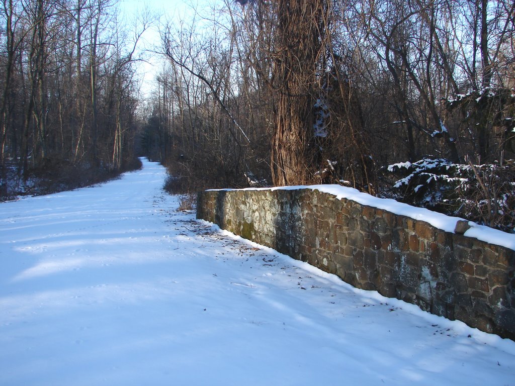
 This beautiful old stone bridge is near the bottom of Roundtop Mountain, just before I emerge from the shelter of the forest on my morning drive to work. I have often walked along this old road, but I don’t start my walks at this spot. I pick up the road another half mile or so deeper into the woods and closer to my cabin. This morning, the trackless snowy road and the bridge called to me, so I jumped out of the car and took a picture in the early morning light.
I suspect this bridge once stood at the entrance to a summer camp, the remains of which I’ve seen down in the valley. All that’s left now is a portion of one bath house and a caved-in stone swimming pool. I have no idea how long ago this camp was last used. The ski resort has been on the mountain for 40 plus years, and I suspect the old camp was abandoned long before that. I wouldn’t be surprised to learn the camp was last used in the World War II era. I don’t know when it opened or what the name of the camp might have been. Even an old topographical map I have of the region doesn’t show it.
Deeper in the forest, the old road follows a stream, passes a small pond and then continues along the stream, eventually emerging on the other side of the mountain as a public road that is marked as a "dead end" on that side of the mountain. It's not really a dead end road, but the public portion of the road does end at a farm where the forest ends (or begins depending on your point of view).
Perhaps it is only the freedom of the upcoming weekend calling to me, but I'd have given a lot this morning to throw off the day's work obligations and follow this old road through the woods, making tracks in the trackless snow.


3 comments:
Wonderful picture! I wouldn't mind walking down that road too. That old camp sounds like a wonderful photo op.
I can sure share your sentiments. I'm always wondering what is down roads I see, and sometimes I even find out.
pablo
www.roundrockjournal.com
Cathy,
That's a good idea about taking photos of the old camp. I think I will do that--though I will wait until mud season is over or at least on the wane.
Carolyn H.
Post a Comment